
The Maldives Atolls With No Resorts: What Is Actually Out There
Twenty-six natural atolls. Twenty-one administrative divisions. Around 1,190 islands, of which roughly 190 are inhabited and a similar number carry resorts. None of those figures reconcile with each other, and the gap between them contains a whole layer of the country that no travel guide covers: small atolls with nobody on them, isolated islands that belong to no atoll at all, and ring reefs that appear on charts and in no brochure. This is the last piece of our atoll series, and it exists because the honest answer to “what about the other atolls” is not a guide to each one. It is an explanation of why there is nothing to guide you to.
Why the numbers never add up
The reconciliation problem in counting Maldives atolls is structural, and it has three layers rather than two.
The first layer is the 26 natural Maldives atolls: physical coral structures, formed over millions of years, visible from space. The second is the 21 administrative divisions — 20 atolls plus Malé City — which are lines drawn by government for running schools and councils. Our series has covered how those two layers map onto each other: Kaafu bundles four reefs into one division, Ari splits one reef into two, and the Nilandhe atolls match one to one.
The third layer is the one nobody discusses. A set of small atolls, ring reefs and lone islands sits outside the traditional classification entirely. Sources are explicit that it is not clear where these were grouped in the early classification: Ihavandhippolhu, Maamakunudhoo, Goifulhafehendhu, Fasdhutheree, Vattaru Faru, Gahaafaru and Rasdhukuramathi, together with the islands of Alifushi-Ethingili, Kaashidhoo and Thoddoo.
That is ten pieces of geography that the standard count of 26 does not cleanly accommodate. They were later absorbed into administrative divisions, which is why they vanish from most descriptions of the country. They did not vanish physically.

The pieces that fit nobody’s classification
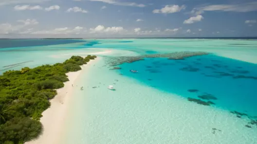
Each of these Maldives atolls and islands is real, named and mapped. Almost none has a resort.
| Feature | Where it sits now | What it is |
|---|---|---|
| Ihavandhippolhu | Haa Alifu | The northernmost natural atoll in the archipelago |
| Maamakunudhoo | Haa Dhaalu | A separate western atoll around Makunudhoo island |
| Goifulhafehendhu | Baa | Three inhabited islands on their own reef |
| Fasdhutheree | Raa | A small atoll named for what lies between five islands |
| Vattaru Faru | Vaavu | A ring reef with no permanent population |
| Gahaafaru | Kaafu | A small atoll north of the Kardiva Channel |
| Rasdhukuramathi | Alifu Alifu | Rasdhoo Atoll — the exception, it has one resort |
| Kaashidhoo | Kaafu | A lone island with its own lagoon, 86 km out |
| Thoddoo | Alifu Alifu | A lone island in open ocean, agricultural |
| Alifushi-Ethingili | Raa | Islands sitting apart from the main reef |
Only one of these ten Maldives atolls and islands carries a resort, and that is Rasdhoo, where Kuramathi occupies the western side. The other nine hold fishing communities, farmland or nothing at all.
Haa Alifu is the clearest example of how this works administratively. The division consists of 43 islands spread across two natural atolls — Ihavandhippolhu and northern Thiladhunmathi — separated by the Ihavandhoo Kandu channel. Fourteen are inhabited and 29 are not. Our Haa Alifu guide covers the accessible parts.
What the names actually mean
This is the part of the Maldives atolls story that repays attention, because the names are descriptive rather than arbitrary and almost nobody translates them.
Fasdhutheree means, literally, what lies between the five islands. The atoll is named for its own position.
Goifulhafehendhu is an amalgamation of the names of its three inhabited islands: Goidhoo, Fulhadhoo and Fehendhoo. The reef is named for everybody who lives on it.
Faadhippolhu — the natural atoll under Lhaviyani — comes from Faadhoo island. The traditional name was Faadu Bur, meaning a complete circle from Faadhoo back to Faadhoo, which is as good a description of an atoll as anyone has managed.
Maamakunudhoo means the major division to which Makunudhoo belongs, with mā carrying the sense of principal.
Ari comes from Ariadhoo, an important religious centre in the pre-Islamic era. Thiladhunmathi comes from Thiladhoo, an island now absorbed into Dhiddhoo. Miladhunmadulu comes from Milandhoo on the eastern fringe. The Malé atolls are named for the capital, which has held that role since 1117.
Read together, these tell you something the tourist map cannot: this is a geography named from the inside, by people who lived on specific islands, not a grid imposed from outside. The code letters that replaced them — Kaafu, Baa, Alifu — were an administrative convenience. Sources note they have been a persistent source of confusion among foreigners ever since.
How the empty islands are actually used
Absence of a resort does not mean absence of purpose, and the uses these islands are put to are more varied than most visitors realise.
Some are picnic islands, leased by nearby resorts for day excursions and sandbank trips. They have no buildings and no water supply, and they exist on the tourism map only as a destination for a boat that returns the same afternoon.
Others are agricultural. Thoddoo grows watermelons on a commercial scale, and several uninhabited islands across the country carry coconut plantations worked by crews who travel out and back rather than living there.
A third group is industrial. Fisheries facilities, fuel storage and waste handling all occupy dedicated islands, because an archipelago cannot concentrate those functions on the same islands people live on. These rarely appear in any tourist-facing description of the Maldives atolls, and they are a substantial part of what is actually out there.
A fourth group is simply vegetation and nesting habitat. Uninhabited islands support seabird colonies and turtle nesting beaches, and their emptiness is the reason they still do.
The practical point for a traveller: an island marked uninhabited on a chart is not necessarily undisturbed, and an island marked as having no resort is not necessarily unused. The categories describe tourism, not activity.
The northernmost inhabited island
Worth singling out, because it illustrates what a Maldives atoll with no resorts actually looks like on the ground.
Thuraakunu sits at the top of Ihavandhippolhu, and it is the northernmost inhabited island in the Maldives. About 200 people live there. India lies roughly 590 kilometres to the northeast.
There is little for a visitor to see, and landing is difficult: the island has no lagoon and takes the swell directly. That combination — no lagoon, exposed approach, small population — is the practical reason there is no tourism, and it applies across most of what this article covers.
An island without a lagoon cannot host a resort in the Maldives atoll sense. The lagoon is the product. It provides the shallow turquoise water, the sheltered anchorage, the seaplane landing area and the site for overwater villas. Without one, you have a rock in open ocean with people fishing off it.
Vattaru: a ring reef with nobody on it
The clearest example of a Maldives atoll with genuinely no one on it sits at the southern end of Vaavu.
Vattaru Faru is a small ring-shaped reef, administratively part of the Vaavu division alongside the natural Felidhoo Atoll. It has no permanent population and no resort. Divers reach it from liveaboards working the central atolls.
Vaavu as a whole is the least densely populated division in the country, with just five inhabited islands. That emptiness is precisely what makes its diving what it is, and it is worth understanding that the Maldives contains this kind of space at all — a complete ring reef, mapped and named, with nobody living on it.
Getting to the inhabited part is straightforward enough: roughly an hour by speedboat from the capital to Fulidhoo, or about three hours by public ferry. Vattaru itself needs a boat and a reason.
What this means for the country’s own numbers
One consequence of the three-layer structure is that national statistics about the Maldives atolls are harder to read than they look.
Counts of islands across the Maldives atolls vary between roughly 1,190 and 1,192 in official use, and figures above 2,000 circulate as well because sandbanks and lagoon features can be counted or not counted depending on the definition applied. Neither range is wrong; they answer different questions.
The same applies to resort counts. A figure of around 190 resort islands is commonly cited, but properties occupying two linked islands, resorts under construction and islands leased but not yet developed all shift the total depending on the year and the counter.
Population figures carry a subtler version of the problem. Because Malé City is administratively separate from the atoll that physically surrounds it, atoll populations exclude the capital entirely — which is why a page quoting hundreds of thousands of residents for a central division has silently folded the city back in.
The practical rule when reading any Maldivian statistic: check what is being counted before comparing it to anything. This is a country where the definitional questions are genuinely unsettled, and the disagreements between sources documented across this series are mostly definitional rather than careless.
Why there are no resorts
Four reasons the empty Maldives atolls stayed empty, and they are more specific than “too remote”.
No lagoon. As with Thuraakunu, an exposed island without sheltered water cannot support the Maldivian resort model at all. This rules out more islands than distance does.
Distance from a runway. Resorts need guests to arrive within a day. Islands more than about an hour’s boat ride from a domestic airport are commercially difficult regardless of how good the reef is. Our transfer comparison sets out the practical limits.
Population. Under Maldivian practice, resorts occupy islands with no permanent residents. An island with a fishing community is not available for resort development; it can host guesthouses instead, which is a different business with different economics.
Size and freshwater. Small islands lack the groundwater lens to supply a resort, and desalination changes the economics substantially at small scale.
Those four filters, applied across the roughly 1,190 islands of the Maldives atolls, are what produce a country where most of the map is empty and the visible part is concentrated in a handful of central atolls.
What you can actually reach
Not every Maldives atoll in this article is off limits, and some are genuinely worth the effort.
Thoddoo is reachable by ferry or speedboat and has guesthouses. It is agricultural — watermelons, notably — and sits alone in open ocean north of the main Ari reef. Our North Ari guide covers access.
Kaashidhoo has guesthouses and Buddhist temple ruins at Kuruhinna Tharaagandu, dating from before the conversion to Islam in 1153. It sits 86 kilometres out and takes most of a day by ferry.
Gahaafaru has one inhabited island and wreck diving on the outer reef, but no accommodation to speak of.
Goidhoo, Fulhadhoo and Fehendhoo in Baa all have small guesthouse operations and sit well away from the Hanifaru crowds.
Everywhere else on the Maldives atolls list above is a day trip at best, and for most travellers not even that. The dress code rules apply on every inhabited island here.
Why we are not writing guides to these
A note on editorial method, because this article exists instead of ten thin Maldives atoll guides.
Our content plan called for complete coverage of the 26 atolls. Completing it literally would have meant publishing guides to places with no accommodation, no transport link and nothing for a visitor to do — pages padded with generic description because there is no specific description available.
That is how most “complete” atoll coverage online gets built, and it is why so many of those pages contain errors. When there is nothing to say about a place, the temptation is to say something anyway.
So the coverage is complete in a different sense: every one of the 26 natural atolls is now accounted for, either by a full guide where there is something to guide you to, or by an honest entry here where there is not. Our ranking of the best atolls and the piece on which to skip handle the same question from the other direction.
What the empty parts tell you
Something worth taking away about the Maldives atolls, beyond the practicalities.
The Maldives presents itself as a resort country, and roughly 190 resort islands is a substantial industry. But that is well under a fifth of the islands, and the Maldives atolls in this article are not exceptions — they are closer to the norm. Most of the Maldives is empty reef, uninhabited island and open water.
That has consequences for anyone assessing environmental claims about the country. Reef condition varies enormously between heavily used central atolls and untouched outer ones, and national averages conceal both ends. It also explains why the diving in remote divisions like Huvadhu carries a fraction of the traffic that Malé-area sites absorb.
And it is a reasonable corrective to the idea that the country is fully mapped and fully commercialised. Ten named pieces of geography could not be placed in the traditional classification. A ring reef in Vaavu has nobody on it. An island 590 kilometres from India takes the swell head-on with 200 people living behind it.
How this series covered the rest
Worth setting out, since this is the closing piece and the coverage now runs to seven articles.
The naming explainers came first, because they fix a structural problem rather than adding new territory. Kaafu explains why North and South Malé are one division and why the capital is not in it. Ari explains the 1984 split and what the northern half quietly absorbed. The Nilandhe atolls explain a shared name covering two separate reefs. Huvadhu corrects the largest-atoll claim and sets out what happened in February 1962.
Then the practical pieces. The selection framework works backwards from arrival time and trip length rather than forwards from reef quality. Rasdhoo covers the one genuinely new destination — a separate reef with resident hammerheads and guesthouse pricing.
This article closes the set. Between them, every natural atoll in the country now has either a full guide or a documented reason why it does not need one. The full hub links the individual atoll guides, and the best and skip pieces rank what remains.
One thing the series has confirmed repeatedly: most disagreement between published sources about the Maldives atolls is definitional rather than careless. Island counts differ because sandbanks may or may not count. Population figures differ because the capital may or may not be included. Size rankings differ because two adjacent atolls may or may not be treated as one structure. Knowing which question a number answers matters more than knowing the number.
Frequently asked questions
How many Maldives atolls have no resorts? At least nine of the ten small atolls and isolated islands outside the traditional classification carry no resort. Several full administrative divisions also have very limited resort development.
What is the northernmost island in the Maldives? Thuraakunu, in Ihavandhippolhu, with around 200 residents. India is roughly 590 kilometres northeast.
Can I visit an atoll with no resorts? Some, yes. Thoddoo, Kaashidhoo and the Goidhoo group have guesthouses. Others have no accommodation and can only be reached by private boat or liveaboard.
Why do the atoll numbers never match? Because 26 counts natural coral structures, 21 counts administrative divisions, and a third layer of small atolls and lone islands fits neither cleanly.
What is Vattaru? A small ring reef at the southern end of the Vaavu division, with no permanent population and no resort. Divers reach it by liveaboard.
Why can’t some islands have resorts? Usually the absence of a lagoon, which rules out the entire Maldivian resort model. Distance from a runway, existing population and freshwater supply account for most of the rest.
Are these atolls worth visiting? For most travellers, no. For anyone specifically wanting empty reef, working island communities or pre-Islamic archaeology, Kaashidhoo and Thoddoo repay the journey.
Does this complete the 26 atolls? Yes. Every natural atoll now has either a full guide or an honest entry explaining why there is nothing to guide you to.
Are any of these Maldives atolls being developed? Development shifts over time as new runways open and leases are granted, so an atoll with no resort today may have one in a few years. Check current listings rather than relying on any page, including this one, for development status.
Can I charter a boat to an uninhabited atoll? Private charters and liveaboards reach most of them, and liveaboard routes through the central Maldives atolls already include stops at places like Vattaru. Independent landings on uninhabited islands are a different matter and may need permission.
Why does this article exist instead of individual guides? Because there is nothing to put in individual guides. Publishing ten pages about places with no accommodation, no transport and nothing to do would mean padding each one with generic description, which is exactly how inaccurate atoll coverage gets built elsewhere.
What to take from this
The Maldives atolls that carry no resorts are not a footnote to the country. They are most of it. Ten named pieces of geography sit outside the classification that produces the familiar figure of 26, and nine of them have no tourism at all.
The reasons are specific rather than romantic: no lagoon, no runway within reach, an existing population, or not enough fresh water. Those four filters shaped the map you see on booking sites, and they explain why the visible Maldives is concentrated into a handful of central atolls while the rest of the archipelago stays empty.
If you want to see any of it, Thoddoo and Kaashidhoo are the realistic options. Everything else needs a boat, a reason and a tolerance for places that were never arranged for visitors.
Next step: the hub covering all 26 atolls pulls the full series together, and the selection framework helps if you are choosing where to actually go.
Verified 14 August 2026 against the government island register, the 2022 Maldives Census, and published accounts of the traditional atoll classification. Where sources are explicit that the historic grouping of certain atolls is unclear, that uncertainty is reported rather than resolved.