
Huvadhu Atoll: Why It Was Split, and Why It Is Not the Largest
Two claims follow Huvadhu Atoll through almost every guide that mentions it. The first is that it is the largest natural atoll in the Maldives. The second is that it was divided into Gaafu Alifu and Gaafu Dhaalu on 8 February 1962 for administrative convenience. The first claim is wrong, and published survey data says so plainly. The second is technically true and deeply misleading, because the division came four days after a gunboat anchored off the atoll’s capital. This guide sets out what the measurements actually show, what happened in February 1962, and what remains of the most self-governing atoll the Maldives ever had.
Not the largest, and the surveys say so
Start with the claim about Huvadhu Atoll that appears most often, because correcting it changes how the rest reads.
Huvadhu Atoll is frequently described as the largest atoll in the Maldives, and occasionally as one of the largest in the world. The first part is not supported. Thiladhunmathi and Miladhunmadulu, taken together as the single natural structure they form, are larger. Huvadhu comes second.
Survey figures published in 2022 put Bodu Thiladhunmathi at 3,788.71 square kilometres against Huvadhu at 3,278.59 — a gap of 510.12 square kilometres. That is not a rounding difference. It is roughly the area of a mid-sized atoll in its own right.
The ranking gets less flattering on the measures that matter to a visitor. By reef area, Huvadhu places third: Bodu Thiladhunmathi leads with 500.70 square kilometres, Ari Atoll follows at 489.40, and Huvadhu trails at 437.90. By land area it places second, with 34.30 square kilometres against Bodu Thiladhunmathi’s 68.70 — less than half.
None of this makes Huvadhu Atoll small. A lagoon of over 3,200 square kilometres is enormous by any standard, and the claim that it ranks among the ten largest atolls on earth is at least defensible. But “largest in the Maldives” is a specific, checkable claim, and it does not survive checking.

The size figures, side by side
The disagreement between sources on the size of Huvadhu Atoll is itself worth showing, because it explains why the “largest” claim persists.
| Measure | Huvadhu | Bodu Thiladhunmathi | Huvadhu’s rank |
|---|---|---|---|
| Total atoll area | 3,278.59 km² | 3,788.71 km² | 2nd |
| Reef area | 437.90 km² | 500.70 km² | 3rd (behind Ari) |
| Land area | 34.30 km² | 68.70 km² | 2nd |
Figures for Huvadhu’s own area circulate as 3,152 km², “just below 3,200 km²” and 3,278.59 km². Land area appears as both 34.30 and 38.5 km². The variation comes from different survey methods and different decisions about where a lagoon ends, not from anyone being careless.
The “largest” claim probably survives because Huvadhu feels largest. Thiladhunmathi and Miladhunmadulu read as two atolls on most maps and carry four separate administrative names between them. Huvadhu Atoll reads as one enormous ring. Perception follows the map, and the map follows administration rather than geology.
Why an atoll this size gets divided
Splitting a natural atoll is uncommon in the Maldives, and the reasons are usually practical rather than political — which is exactly why the 1962 case stands out.
Most administrative divisions do the opposite of splitting. Kaafu Atoll bundles four separate reefs under one label because none is large enough to justify its own council. That is the normal direction of travel.
Splitting happens where a reef is too large for one council to serve. Thiladhunmathi was divided into Haa Alifu and Haa Dhaalu in 1958. Miladhunmadulu became Shaviyani and Noonu. Ari was divided in 1984. Each of those splits followed the same logic: a community at one end of a long reef should not need a full day’s sailing to reach an administrative office.
By that standard, dividing Huvadhu Atoll was overdue. The reef is over 3,200 square kilometres of lagoon with inhabited islands scattered around its whole rim, and Gadhdhoo sits 429 kilometres from Malé. A single council was a genuine practical problem.
Which is what makes the timing so difficult to read as coincidence. The practical case for division existed for decades. It was acted on in the same week that the atoll’s capital was destroyed. Both things can be true: the split was administratively sensible, and it happened when it happened for reasons that were not administrative.
A line drawn four days after a gunboat
Here is the part that almost no guide connects, and it reframes the entire administrative history of the atoll.
In January 1959, the three southern atolls — Huvadhu Atoll, Fuvahmulah and Addu — broke away from the Maldivian government and formed the United Suvadive Republic. The state took its name from Suvadiva, the ancient Sanskritised name of Huvadhu Atoll itself. Its president was Abdullah Afeef Didi, and its capital was Hithadhoo in Addu.
The grievance was economic. The southern atolls had carried heavy taxation on copra exports without corresponding investment, and Addu’s proximity to the British airfield at Gan offered a model for direct trade outside Malé’s control.
The first secession in Huvadhu Atoll was suppressed by June 1959, after the prime minister arrived on an armed gunboat and threatened the atoll’s leaders in person. Addu was shielded by British intervention. Huvadhu was not.
In 1961 Huvadhu Atoll seceded again, in what is locally remembered as the Second Revolt. The response was heavier. On 4 February 1962, a gunboat named Elizabeth Boyer, leased from the Ceylon Navy, anchored off Havaru Thinadhoo, the atoll capital.
Huvadhu Atoll was divided into two administrative districts on 8 February 1962. Four days later.
The proximity of those dates is not usually stated, and the division is almost always presented as a neutral administrative act. Whether the split was formally intended to prevent the atoll acting as a single political unit again is not something the published record states outright. What the record does establish is the sequence: revolt, military response, and the partition of the largest southern atoll into two districts within the same week.
What happened at Havaru Thinadhoo
The events of February 1962 deserve setting out directly rather than being elided into a date.
Havaru Thinadhoo was the wealthiest island in the atoll and the traditional seat of Huvadhu power. It operated nine long-haul ships. Gadhdhoo ran two, Nilandhoo three, Dhaandhoo two — sixteen ocean-going vessels in one atoll, which is what enabled the southern atolls to function as a small maritime trading power.
The island was forcibly depopulated and destroyed. Its population had been over 6,000. Estimates cited on the record suggest as many as 4,000 residents either died of starvation or were killed, and the episode has been described as ethnic cleansing.
Thinadhoo was left uninhabited for four years. The atoll’s administrative seat moved to Gadhdhoo, where it remained for more than a decade before Thinadhoo — by then repopulated — was reinstated as the capital of the southern district.
The Suvadive Republic survived in Addu under British protection until 22 September 1963, when Britain withdrew support and handed the territory back to Malé. The former airfield at Gan later became Gan International Airport.
Not every island supported secession. On Gadhdhoo there was active opposition, and accounts record that opponents were forced into agreement through threats and arson. This was not a united atoll standing against Malé; it was a divided one, which is part of why the aftermath fell so unevenly.
Before the split: an atoll with its own flag
Understanding why Huvadhu Atoll could secede at all requires knowing what it was beforehand.
The Huvadhu atoll chief held a degree of self-government granted to no other atoll in the country. He had the privilege — unique among Maldivian atoll chiefs — of flying his own flag on his vessels and at his residence. That flag was similar in cut to the flag of Nepal, with two central black triangles edged by red and white bands.
An atoll with its own flag, sixteen ocean-going ships and a functioning trade network is not a province. It is something closer to a semi-autonomous polity, and the 1959 secession makes considerably more sense read that way.
The distance helps explain it. The southern district sits roughly 340 kilometres south of the capital, and its outer islands considerably further — Gadhdhoo lies 429 kilometres from Malé. In the era before domestic flights, that was measured in days of sailing.
Huvadhu Bas: the dialect that marks the distance
Isolation left a linguistic mark that survives today and is the clearest evidence of how separate Huvadhu Atoll once was.
Islanders across Huvadhu Atoll speak Huvadhu Bas, a distinct form of Dhivehi. It differs significantly from the standard language, makes heavy use of the retroflex sound, and is understood to retain older forms that the northern dialects have lost. It also retains old Sinhala vocabulary, and is considered closer to Sinhala than any other variant of Dhivehi.
For a traveller this is not an obstacle — English and standard Dhivehi work fine — but it is a genuine marker. The southern atolls of the Maldives are culturally distinct in ways the resort industry never mentions, and language is where the distinction is hardest to miss.
Ibn Battuta noticed the atoll’s difference in the fourteenth century, recording that the Maldives lacked grain except in the province he called Souweid — Suvadiva — where a kind of millet was produced and shipped north to Malé.
What the atoll makes
Two crafts from Huvadhu Atoll carry national reputations, and both are worth knowing about.
The finest mats in the Maldives are woven on Gadhdhoo. The local grass, hau, is dyed in two colours, black and yellow, and worked into the patterned mats known as thundu kunaa. This is the reference standard for the craft nationally.
The master carpenters who built Malé’s Hukuru Miskiy — the old Friday Mosque, the most significant piece of pre-modern architecture in the country — came from Kondey in this atoll. Ali Maavadi Kaleyfaanu and Mahmud Maavadi Kaleyfaanu are named in the record.
There are also Buddhist-period remains here, including temple ruins on Gan, from the centuries before the conversion to Islam in 1153.
The two halves today
The 1962 division produced two administrative districts split along a line running between the channels of Footukandu and Vaarulu Kandu.
| Gaafu Alifu (North) | Gaafu Dhaalu (South) | |
|---|---|---|
| Thaana code | ގއ (GA) | ގދ (GDh) |
| Capital | Vilingili | Thinadhoo |
| Population | 8,334 | 11,587 |
| Islands | 87 | 153 |
| Inhabited | 10 | 10 |
| Airport | Kooddoo | Kaadedhdhoo |
The southern district is larger on every count — more islands, more people, and the historic seat of power. The northern district holds the broader resort cluster and the transport hub at Kooddoo. Our guides cover each: Gaafu Alifu for the northern resorts and channels, Gaafu Dhaalu for the surf and the southern islands.
Both districts sit on the same Huvadhu Atoll reef, and the channels do not check paperwork. A diver working the eastern rim crosses between administrative halves without noticing. The division is real on forms and invisible in the water — which is precisely the pattern set out in our guide to the Nilandhe atolls, where the opposite arrangement applies.
Who lives there now
The two districts hold twenty inhabited islands between them, spread around a reef rim that takes hours to cross by boat.
In the north, Gaafu Alifu’s inhabited islands are Vilingili, Dhaandhoo, Dhevvadhoo, Dhiyadhoo, Gemanafushi, Kanduhulhudhoo, Kolamaafushi, Kondey, Maamendhoo and Nilandhoo. Kondey is the island that produced the carpenters of Malé’s Friday Mosque. Kooddoo, on the northeastern rim, functions as a transport and fisheries hub rather than a village, with a resident population of around 150.
In the south, Gaafu Dhaalu’s named inhabited islands are Thinadhoo, Fares-Maathodaa, Fiyoari, Gadhdhoo, Hoandeddhoo, Madaveli, Nadellaa, Rathafandhoo and Vaadhoo. Gadhdhoo is the mat-weaving island and served as the atoll capital for over a decade after 1962.
Population sits at 8,334 in the north and 11,587 in the south. Those are small numbers for a reef this size — under 20,000 people across 240 islands — and the density tells you something about how the twentieth century treated this atoll. Havaru Thinadhoo alone once held over 6,000.
The dress code and behaviour rules apply on all twenty islands, as they do on inhabited islands throughout the country.
Diving the channels
The scale of Huvadhu Atoll is the point. A lagoon of this size moves oceanic volumes of water through its channels on every tide, and that is what makes the diving here what it is.
Grey reef sharks and silvertips work the channel mouths on incoming current. The sites are genuinely remote, which means they carry a fraction of the traffic that the central atolls absorb, and liveaboard routes increasingly run this far south specifically for that reason.
The trade-off is honest and worth stating. Getting here costs a domestic flight and most of a travel day, resort choice is narrow compared with the Malé atolls, and the marine encounters are not more reliable than South Ari’s whale sharks or Baa’s mantas. What you get instead is emptiness and current. Our ranking of atolls and the piece on atolls to skip set out who this suits.
Getting there
Two domestic airports serve Huvadhu Atoll, one per district, and the naming causes genuine confusion.
Kooddoo serves Gaafu Alifu in the north. Kaadedhdhoo serves Gaafu Dhaalu in the south. A third similar name, Kadhdhoo, belongs to Laamu and is a different atoll entirely — we have a disambiguation guide because bookings do go wrong over this.
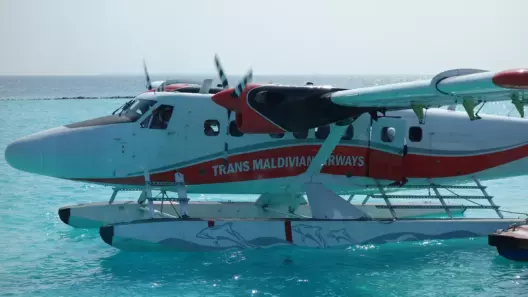
Domestic flights from Velana run roughly an hour, followed by a boat transfer. Seaplanes do not serve this distance practically, so the runway is the route. See the domestic airports guide for schedules and the transfer comparison for costs.
What the distance still costs
The isolation that shaped the atoll’s history has not gone away, and it explains most of what a traveller notices.
Tourism arrived here decades after it reached the central atolls. The first resorts in the Maldives opened around Malé in 1972, and expansion was limited for years by how far a guest could travel from the airport. At 340 to 430 kilometres out, Huvadhu Atoll was simply unreachable within that radius. Development waited for the domestic runway network.
The result is a resort bench that is small but unusually good. Because properties arrived late, they arrived after the industry had worked out what it was doing, and several of the country’s stronger luxury names chose sites on this reef rather than fighting for space closer to the capital.
The counterpart is cost and time. A trip here needs a domestic flight of around an hour on top of the international arrival, plus a boat, which realistically consumes a travel day at each end. Anyone considering fewer than seven nights should read our transfer comparison before committing, and check whether a late arrival forces a night in Malé.
There is a second cost that rarely appears in guides. Remote atolls have thin competition, which means excursion pricing, diving packages and anything bought on the island run higher than equivalent services in the Malé atolls. Emptiness is the product here, and it is priced accordingly.
Errors in published sources
Four recurring problems, including one on a government page.
| Claim | Assessment |
|---|---|
| Huvadhu is the largest atoll in the Maldives | Second. Bodu Thiladhunmathi is larger by 510.12 km² |
| The 1962 division was routine administration | Technically true, but it fell four days after the gunboat arrived |
| Gaafu Dhaalu has 153 islands, 10 inhabited | The named list gives nine; the count of ten appears without a tenth name |
| Independent travellers need special permission to visit inhabited islands | Appears on a government page; the permit system was dismantled when guesthouses were legalised in 2009 |
The last is the most consequential for a traveller, because it appears on an official source and would discourage independent travel that is in fact permitted. Verify current requirements before relying on any page that states this, including ours.
Frequently asked questions
Is Huvadhu Atoll the largest in the Maldives? No. It is the second largest natural atoll. Thiladhunmathi and Miladhunmadulu together form a larger single structure, measured at 3,788.71 km² against Huvadhu’s 3,278.59 km².
Why was Huvadhu Atoll divided? It was divided into Gaafu Alifu and Gaafu Dhaalu on 8 February 1962, four days after a gunboat anchored off the atoll capital during the suppression of the Suvadive secession. Sources present the division as administrative; the timing is a matter of record.
What was the United Suvadive Republic? A breakaway state formed in January 1959 by Huvadhu, Addu and Fuvahmulah, named after Suvadiva, the ancient name of this atoll. It survived in Addu under British protection until September 1963.
What happened at Thinadhoo? The island was forcibly depopulated and destroyed in February 1962. Its population had exceeded 6,000, and estimates suggest as many as 4,000 died. It stood empty for four years.
What are the capitals? Vilingili for Gaafu Alifu and Thinadhoo for Gaafu Dhaalu. Before the division, Thinadhoo was the seat of the whole atoll.
What is Huvadhu Bas? A distinct dialect of Dhivehi spoken across the atoll, retaining older forms and old Sinhala vocabulary, and considered closer to Sinhala than other variants.
Which airport should I fly to? Kooddoo for the northern district, Kaadedhdhoo for the southern. Do not confuse either with Kadhdhoo, which serves Laamu Atoll.
Is the diving worth the journey? For channel diving with current and very few other boats, yes. For guaranteed large-animal encounters, other atolls are more reliable.
How many days should I plan? Seven nights minimum. A domestic flight of about an hour sits on top of the international arrival, and a boat transfer follows that, which realistically consumes a travel day at each end of the trip.
What to take from this
Huvadhu Atoll is the second largest natural atoll in the Maldives, not the first, and third by reef area. It is also the only atoll whose chief flew his own flag, the only one to secede twice, and the one whose partition into two districts followed a military operation by four days.
Read the two Gaafu districts as halves of one reef with a shared history rather than as separate destinations. The channels are the reason to come. The history is the reason it is worth knowing which half you are standing in — and why the people there speak differently from the people in Malé.
Next step: read the Gaafu Alifu and Gaafu Dhaalu guides, and check the airport disambiguation before booking a domestic flight.
Verified 14 August 2026. Area figures from survey data reported in 2022; population and island counts from the government island register and the 2022 Maldives Census. Historical events of 1959–1963 are drawn from published accounts; casualty estimates at Havaru Thinadhoo vary between sources and are presented as estimates.